Welcome to our spring newsletter providing insights into local planning and development happenings in and around the Sunshine Coast and Wide Bay Regions. Topics for review include:
- Can Airbnb be Regulated?
- From Cootharaba to Coolangatta – Shaping SEQ
- Cross River Rail Project – What About the North Coast Line?
- Summer Bushfire Hazard
- Be Warned! Planning Schemes Have Been Amended
- Other News
We would love to hear any feedback about the articles and any suggestions you may have for future articles.
Regulating Airbnb
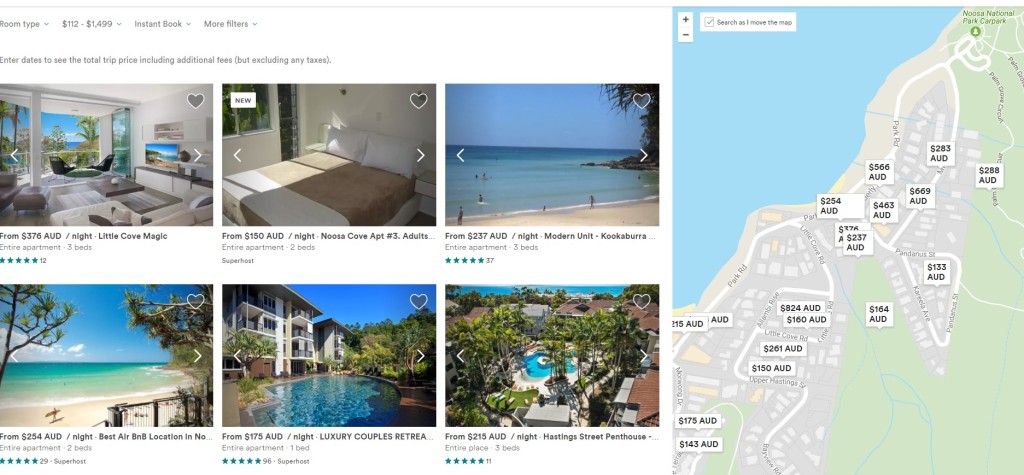
Airbnb has turned sharing our homes and living spaces with strangers from a fringe idea into an income. Much has been written in the media about this disruptive land use change, with most knowing somebody who is making a bit on the side by renting their house out during holiday time to fund their own holiday.
Over the last 5 years Council’s have taken a hands off approach to this disruptive land use change, however is this all about to change?
The Noosa Plan currently requires an impact assessable planning application for a bed and breakfast use, while the Sunshine Coast Council Planning Schemes is more self-regulating allowing for up to 6 people stay for no more than 14 days, so long as the resident owner manages the stay and is reserved a room. However, with more than 1,000 listings on the Coast for short stay accommodation, there have been only 6 applications approved for a ‘bed and breakfast’ use in the last 5 years by both Councils.
Rather, Council has taken a ‘hands off’ approach only responding to complaints from neighbours when the temporary AirBnB residents get out of hand (i.e. party houses). In which case, the owner stops advertising, or buys a house nearby with more understanding neighbours.
Local Councils are having to respond to the other neighbours having to put up with the amenity impacts (noise, car parking, rubbish etc.). Academics and strategic planners have been complaining about the societal concerns associated with the impacts on the local rental market and social cohesion in these transient tourist areas. And now the tourism lobby are now complaining AirBnB is impacting on hotel chains bottom lines. Concern is raised about the lack of regulation of people running hotels out of residential buildings, and highlighting how Airbnb hosts do not collect hotel taxes, tourism levies and are not subject to the same health and fire safety regulations that hotel operators must follow.
In response, Noosa Council recently announced they are looking at ways to formalise AirBnB’s by creating a management policy (and a way of taxing) for the use within the new planning scheme. They have also asked LGAQ to lobby the State government to develop a policy response.
Considering other State Laws recently brought in to control ‘disruptive’ changes such as Uber (as a result of the Taxi Industry lobbying), which include the requirement for licences and annual fees – could this be the start of regulation for this disruptive land use change?
A new plan for South East QLD – ‘From Cootharaba to Cambooyah to Coolangatta and everywhere in between’
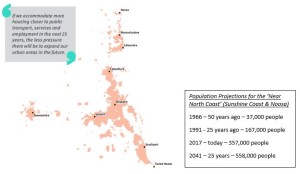
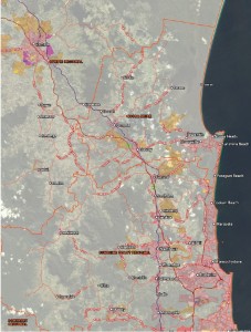
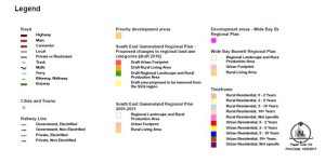
Shaping SEQs is the third ‘big’ regional plan for South East Queensland and sets the parameters for land use planning to grow from 3.5 million to 5.3 million people in the next 25 years.he plan uses all the modern planning terms including responding to ‘global megatrends’, ‘missing middle housing’, ‘sweating our assets’, ‘inter urban breaks’, ‘place making’, ‘disruptive technology’. However, what is much different from the previous plans to this version is the more collaborative approach the State are proposing to ‘work with’ the 12 local governments, which make up the region.
What does it mean for the Sunshine Coast?
-
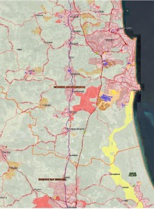
More development towards Brisbane with the expansion of ‘Beerwah East’ as a Ministerial Designated Area. Giving it special status as a large growth area requiring significant state infrastructure investment for its urban development.
- Halls Creek (south of Stockland’s Aura development) is identified as a potential ‘Future Growth Area’. This means the land has at least been shown on a map for expansion in time the next update of the plan in 5 years.
-
The Sunshine Coast is required to accommodate 53,700 new ‘infill’ unit developments, and 33,300 new ‘greenfield’ developments over the next 25 years. Equivalent to 2,148 new units & 1,332 new detached house lots per year.
Opinion – A lot of the new detached house growth and development will be focussed on the southern end of the coast. Although ambitiously targeting more unit developments, the plan is for more quarter acre block on the outskirts of greater Brisbane.
What does it mean for Noosa?
-
No expansion of the urban footprint for the next five years.
-
The State want to see more consolidated development with 4,800 new ‘infill’ units, and 1,600 new ‘greenfield’ houses over the next 25 years. Equivalent to 192 new units & 64 new detached houses per year.
Opinion – These are fairly low and unambitious targets for growth in Noosa. Even with many sites being zoned for higher densities it is the individual landowner who is deciding whether it is worth building another 10 bedroom house on their unit zoned land near the river/beach.
What does it mean for Gympie?
-
Despite having a new 4 lane highway connecting Gympie to Brisbane making travel times less than 2 hours, there are no State urban footprint restrictions.
-
Gympie Council is planning for the overflow of South East Queensland and recently endorsed the Southside Local Development Area Structure Plan to accommodate a further 1,200 dwellings in an emerging uan area.
Opinion – Considering the greater connection with Brisbane and the Sunshine Coast, as well as the cheap cost of land in the area it will be interesting to watch Gympie’s growth over the coming years.
Regional plans are reviewed generally every five to seven years. Feel free to come in and speak to our qualified and experienced planners, who can provide greater insights into the opportunities and constraints for appropriate land development within the region.
All Aboard the Cross River Rail Project! What about the North Coast Rail Line?
By Jack Lewis
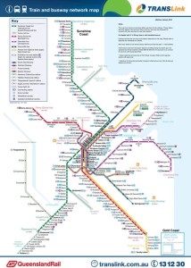
The South East QLD transport network connects the region from Gympie to the Gold Coast. As a sometimes user of the network, I can attest to the fact that the network is pretty efficient, air conditioned and modern compared with other regions and countries.
However in South East Queensland the car is still the dominant form of travel, and while I can get a train from Gympie to Varsity Lakes that takes just under 5 hours, I predominantly choose to drive the 3½ hours, endure the tolls, roadworks and the overcrowded Nudgee service centre toilets.
Brian Feeney from the University of Queensland recently commented that the push by the QLD State government for the Cross River Project (reinforced by the Shaping SEQ plan) provides for a second railway connection through the Brisbane CBD, but at the expense of decentralisation. He argues this large infrastructure spending will serve areas that already have comparatively good public transport services, whereas the suburban and coastal areas where most people live would continue to have limited transport options.
Give most people a proper rational choice between driving and catching good public transport, and the decision will be between what is cheaper, more efficient and more environmentally sensible. If driving to Brisbane from the coast for and having to be somewhere by a certain time, most still choose driving.
The big growth for the coast in the Shaping SEQ plan document is to open up the southern end of the coast with new Stockland houses. Isn’t it time the State also pushed for a large infrastructure announcement for the North Coast Rail Line?
Summer Bushfire Hazard
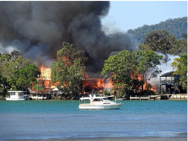
Spring is bushfire season in our region. We have already had some intense bushfire’s early in the season with houses being lost on the Noosa North Shore and evacuations at the southern end of the coast. Bushfire hazard planning is of critical importance to any new development.
Noosa Council recently refused an aged care facility on part of the Noosa Civic site, with the bushfire hazard risk likely to unduly burden disaster management response and recovery capacity and capabilities. New developments on the south end of the coast also forced residents to flee from their new estate houses.
Come and speak to our experienced and qualified planners who can assist in providing you the upfront information to avoid a costly Council refusal, or appropriate design responses to help manage bushfire risk.
Be Warned! Check how Existing Planning Schemes Have Been Amended To Align with New Planning Act
The new Planning Act commenced in July and introduces new terminology, processes and procedures. Most local governments have also amended their plans to align with the new Planning Act. However, there is no need for local governments to advertise or identify the amendments made to the plan.
Certain local governments have taken this opportunity to improve and clarify their previous local planning instrument/scheme without the need to undergo public consultation. It has been discovered that one such Council has amended the following requirements:
- Reducing the number of lots that can be developed for dual occupancy by over 50% (not allowing them to be located next to one another);
- Introduced a maximum height in metres across all zones, rather than the previous and admittedly vague reference to height in storeys; and
- Further restrictions on the subdivision of rural land for primary production (which is undefined).
Anyone who was considering to proceed with a development application under the previous Sustainable Planning Act is advised to check with a consulting planner to clarify the changes which may have resulted with the introduction of the new Planning Act.
Other News
The Sunshine Coast Council just can’t catch a ‘break’. With the Halls Creek expansion included within the Shaping SEQ Plan, despite Mayor Jamieson being vehemently opposed to Halls Creek being a potential Growth Area. Considering the break is currently approximately 20km wide, at least it’s not as narrow as the 2km between Ormeau and North Coomera on the Gold Coast.
Gympie is still on track to utilise more ‘Sun’ than the ‘Sunshine’ Coast, as a massive $2 Billion dollar solar farm on the outskirts of Gympie is in the approval process. If completed, the solar farm will power over 315,000 homes.
All the good weather has resulted in Section C of the Bruce Highway upgrade nearing completion, with the real possibility of the highway being opened before Christmas.
Note: If you’re having trouble downloading the links – Right Click the link and ‘Open in Incognito Button’ (Google Chrome) or Right Click the link and ‘Open in New Window” (Internet Explorer).
Contributors:
Jack Lewis B.Sc Hons UNSW, M.Plan OTAGO
Greg Martoo, B App Sc (Surv), Dip URP, M App SC (Urban Design), MPIA, MSIA
Certified Practising Planner, Registered Cadastral Surveyor
Nadine Gorton BRTP, Grad Cert. Mgmt
Sarah Cole BA (Pol Sci), LLB, L5B (Grad Cert Legal Prac)
|
