Archive for Queenlsand

Feedback requested by Gympie Regional Council on Final draft of Structure Plan for Southside LDA

Feedback requested by Gympie Regional Council on Final Draft of Structure Plan for Southside Local Development Area

160923_Draft Local Development Area Structure Plan 160923_draft-southside-lda


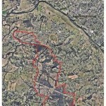
When the current planning Scheme over the Gympie Regional Council area first came into force in July, 2013, it limited future subdivision and land use development in three precincts around the city of Gympie until structure plans were adopted for each respective area by the Gympie Regional Council.  These three precincts are defined as local development areas in the planning scheme and within the localities of Southside, East Deep Creek and Victory Heights https://www.gympie.qld.gov.au/planning-scheme

Martoo Consulting has a long history and extensive experience in dealing with development proposals in and around each of these precincts.  Because of this Martoo Consulting has been liaising with Gympie Regional Council on Council’s proposal to adopt structure plans over these local development areas since before the current Gympie Regional Council planning scheme (2013) was introduced.  More recently Martoo Consulting has made submissions to Gympie Regional Council on behalf of several landowners on the preliminary Draft Structure Plan for the Southside Local Development Area.  Gympie Regional Council has recently released the final draft Structure Plan and has invited feedback from landowners and the broader community until 5pm on 23 December 2016.  Again Martoo Consulting is working with certain landowners and the general community to help ensure that their interests are better represent in the adopted Structure Plan for the Southside Local Development Area.    Martoo Consulting can be contacted if any assistance is required in providing feedback to Gympie Regional Council.
 

Changing land development scheme in the Gympie Region

3-02

Superseded Planning Scheme can no longer be requested after 1 July 2014

The Gympie Regional Council adopted the current 2013 Gympie Regional Planning Scheme on 1 July 2013, and as such, the one year anniversary for the take effect date is fast approaching – in less than a month from now.  Developments lodged to the Gympie Regional Council after 1 July 2014 will no longer be able to request assessment under the superseded 2005 Cooloola Scheme.

In some instances, this can significant affect the viability, profitability and design outcomes for the development of land.  It is suggested that even if you are considering developing land in the next 5-10 years time, that you urgently contact Martoo Consulting to conduct a due diligence exercise.

Our planners have the requisite experience to promptly provide advice on whether your approvals for possible future development should be started today – to avoid missing out.

Existing landholders, potential purchasers, and developers take note – this is an exercise which simply must be undertaken for anyone considering developing land in Gympie.

Infrastructure Charges for Developments to Change

State-wide framework to potentially alter local authorities’ infrastructure charges for new developments

3-01

New developments increase the demand on local infrastructure such as roads, water and sewerage. Developments can range from homeowners subdividing their block to major developers building a whole new community.

When local authorities approve a development application, the applicant may be required to pay an infrastructure charge to the local authority. Local authorities use this money to upgrade infrastructure and make sure neighbourhoods have the services they need.

Proposed Infrastructure Planning and Charging Framework

The Department of State Development, Infrastructure and Planning has produced an Infrastructure Planning and Charging Framework that is intended to be fair, clear and simple, striking a balance between local authority sustainability and development feasibility.

The draft framework incorporates four key elements:

A Fair Value Schedule of charges that encourages local authorities to apply fair infrastructure charges.

  • A Priority Development Infrastructure program that will see the state co-invest in development and economic growth in local communities.
  • An investigation into sensible infrastructure standards set by the state.
  • Transparent and consistent legislative changes.

The draft framework was presented to industry representatives and then presented to State Parliament in May.

Should you want to discuss what the change to infrastructure charges may bring for a development in a particular area, please do not hesitate to contact Martoo Consulting to have a planner assist with your development enquiry.

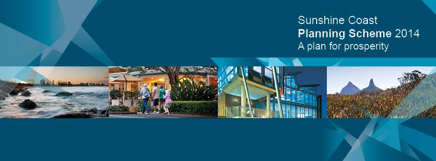
Sunshine Coast Planning Scheme 2014 commences

SC Planning Scheme 2014

The new Sunshine Coast Planning Scheme 2014, prepared by the Sunshine Coast Regional Council officially takes effect from today, Wednesday 21 May 2014.  This new scheme had previously been adopted by Council on 14 April 2014, and gazetted on 2 May 2014, however today is the official day in which the new scheme supersedes the previous Maroochy Plan 2000 and Caloundra City Plan 2004.

Over the next twelve months, it will be possible to lodge applications under either the new Sunshine Coast Planning Scheme 2014, or the superseded schemes depending on where a particular site lies. During this time it will therefore be critical to review development proposals against both schemes to ensure the best outcome for a particular site.

Martoo Consulting actively consults in the Sunshine Coast region, and has been involved in development and planning on the Sunshine Coast and in Gympie for over a decade.  Our planners consider the new scheme will present many opportunities for sustainable and suitable development of the region, and can assist anyone in interpreting and analysing the impact of the new Sunshine Coast Planning Scheme.

Development Assessment Fees in Queensland: Overhaul and Increase

State Assessment Fees to follow “cost-recovery” model

Developers proposing to undertake development requiring extra assessment by the State will incur a higher fee from July 2014 under a planned “cost-recovery” model released by the Queensland Government in February.  Some aspects of development in Queensland are considered to warrant the assessment against interests of the State, for impacts chiefly upon their assets such as roads, railways, national parks, environmentally sensitive areas, waterways, agricultural land suitability, and vegetation management.  Any application made to a Local Council for a land development, if it is of interest to the State, currently gets referred to the relevant State Department for assessment, through the State Assessment Referral Agency.

The fees for this assessment currently vary, with some assessments priced at zero, and some in excess of thousands of dollars.  In order to recover approximately 64% of costs ($25.3 million) for its assessments of development applications, the State is proposing that no assessments will continue to be priced at zero, and the existing fee structure recorded in Schedule 7A of the Sustainable Planning Regulation will be overhauled.  The Consultation Regulatory Impact Statement proposes that a weighted fee is to be applied, based upon the time it takes for the State to typically make each certain type of assessment.  There are to be five fixed fee levels, with the base fee at around $700, and the maximum fee at around $11,000.

What does this mean for developers of land in Queensland? In most cases, it means that it will cost more to undertake any type of development involving the State as a concurrence agency.  This has a variety of implications, but typically it would seem that smaller developments that inconsequentially trigger State assessment stand to suffer the most from this policy, due to a high cost relative to their development’s returns.  That being said, the State is proposing that for some potential impacts, a quick assessment of likely impacts can reduce fees.  If a no impact is likely, the fee is applied as cheaply as possible (between $700 and about $2500), but for high likely impacts, fees can be as high as about $11,000.

The most frequently referred State agency for development assessments is the Department of Transport and Main Roads (DTMR).  This referral currently has an assessment fee priced at zero, and can be implicated with many small but also some large developments, based upon their proximity or likelihood of impacting State transport networks (mainly roads).  For the estimated number of assessments in 2014-15, referrals to DTMR account for approximately 36% of the 7040 assessments.  It is considered that much of the assessment revenue would therefore come from triggers relating to DTMR and State-controlled roads, at the cost of the applicant.

It is worth noting that this assessment fee may be in addition to requests for certified reports by consultant Engineers, Scientists, or other suitably qualified persons.  This isn’t a new occurrence, and has been a shift in the last couple of years, which acts to further complicate the process for anyone wishing to do their own development assessment.

The State’s policy does mean that those wishing to profit from the development of land will wear a more equitable share of the costs; a cost that taxpayers had previously borne.  This is an ethical and logical step.  The policy in it’s current form isn’t without potential issues however, including chiefly the basis of the cost being for the historic time it takes for the State to make it’s assessment on certain matters.  These times fluctuate for a variety of reasons; individual assessor performance, change in policy, and difficulty of assessment due to the non-local base of assessor or non-technical base of the assessor.  Further, it is suggested that a Risk-SMART type arrangement would provide further equity for developers who engage experienced consultants, who prepare reports and plans which significantly reduce the time and complexity of the State’s assessment.

The most encouraging section of the policy is the Government’s aim to continually review the fee structure; to ensure that any issues arising from the framework are addressed and any bumps ironed out.   The Government is obviously hoping it’s already got the balance right between cost and outcome, though the fee for some assessments might still be hard for some applicants to swallow, particularly small developments where the trigger for assessment has arisen from what may be perceived as a trivial or inconsequential matter.

If you’re considering a development that you believe may implicate a State assessment, it may be best to consider going ahead with the development now to avoid a potential rise in referral costs. Please contact us for a site-specific assessment, and we can advise on what the potential difference in costs may be.

Planning reform in Queensland

Updates on the Newman Government’s State planning reforms

If you’ve been active in the development space over the last few years, you may have noticed the incremental roll-out of the Newman Government’s policy and planning legislation reform, significantly changing the game for developers in Queensland.

This newsletter will chronicle the release of reforms as they are announced and as they come into force, helping distil what the changes mean for those in the industry, and what could arise out of the various shifts in focus which have been set in motion by the Newman Government.

So far we’ve seen significant changes from 2013, including the following:

  • Installment of the State Assessment and Referral Agency (SARA) and online myDAS portal;
  • State Development Assessment Provisions (SDAPs)
  • Single State Planning Policy;
  • Queensland Planning Provisions;
  • Sustainable Planning Act and Other Legislation Ammendments (SPOLA) Act 2012;
  • Environmental Protection (Greentape Reduction) and Other Legislation Amendments Act 2012; and
  • Vegetation Management Amendment Act 2013 (and self-assessable codes)

With the following milestones yet to come in 2014 and 2015:

  • Changes to infrastructure charges framework – mid 2014
  • Planning for Queensland’s Development Act (to replace the Sustainable Planning Act) – late 2014-mid 2015
  • Updating regional plans – to the end of 2014
  • Updating of local planning schemes – ongoing

All of these changes have a significant impact upon the development application process involving almost every type of conceivable type of urban land development in Queensland.

Accordingly, certain types of development activity regulated under planning or environmental legislation, which was previously unviable, may now be achievable with the effects of the reform.  Conversely, these changes may impose different or further challenges or restrictions upon land use matters in Queensland.

Time is the critical element here, and finding out where your development stands sooner rather than later could add significant advantages and save you time and money through the concept design and assessment stages.

If you would like to discuss a particular development with us, and how it’s status may change with the roll out of State legislation or policy, get in contact with our Gympie or SunshineCoast office and one of our staff will assist with your enquiry.


The changing face of development in Queensland: Vegetation Management

New regulations govern the use of vegetated land balancing economic and environmental outcomes

Vegetation Management

The legislative and policy framework governing vegetation clearing in Queensland for a range of land uses and development scenarios has changed, with aims to balance good environmental outcomes with correspondingly appropriate development proposals.  Accordingly, development that was previously prohibited or difficult to carry out due to the structure of the previous framework may now be possible, providing that a good case be made for the development against the criteria of the new framework.

The assessment of clearing generally still depends on the following considerations:

  • the type of vegetation (as indicated on the new regulated vegetation management map and supporting maps);
  • the tenure of the land (e.g. freehold or Indigenous land);
  • the location, extent and purpose of the proposed clearing; and
  • who is proposing to do the clearing (e.g. state government body, landholder).

The recent shift provides a raft of significant changes, including different exemptions for clearing purposes, new self-assessable codes, and a new simplified mapping of regulated vegetation over lots in Queensland.  The vegetation categories on the new map are:

  • Category A (red): areas subject to compliance notices, offsets and voluntary declarations
  • Category B (dark blue): remnant vegetation
  • Category C (light blue): high-value regrowth vegetation
  • Category R (yellow): regrowth vegetation within 50m of watercourses in priority reef catchment areas
  • Category X (white): areas not regulated under the Vegetation Management Act 1999.

A significant change for most of the developments Martoo Consulting has experience in gaining approvals for – being small subdivisions to large estates, duplexes to multi-storey complexes and shopping centres, schools to marinas and community infrastructure, and even backpackers and bed and breakfasts – is the change in level of assessment from 2 hectares to 5 hectares.  This means that lots less than 5 hectares in area will not be assessed for clearing proposed as part of a development.

The new self-assessable codes and clearing exemption purposes will also likely provide for some significant changes in terms of level of assessment; however these purposes and exemptions tend to be more circumstantial and applicable on a case-by-case basis.

In terms of the outcomes required of developments assessed against the State’s development assessment for vegetation matters, a renewed focus has been cast upon “environmental offsetting” as an acceptable outcome for some clearing that cannot be avoided or minimised.  Offsets can be made either through direct offsets (suitable land with good quality vegetation under an on-title security such as a covenant) or indirect offsets (the payment of an appropriate sum to the government), means that the environmental impact may be considered economically quantifiable and financial penalties enforced accordingly,  instead of the environmental damage being unequivocally prohibited.  The process is somewhat complex, requiring typically an amount of field surveying to determine the ecological equivalence of both the land to be cleared, and in the case of direct offsets, the land provided as an offset.

Martoo Consulting has experience in managing offsets for properties in Queensland, though a significant change to the Queensland Biodiversity Offsets Policy (QBOP) has been earmarked by the Department of Environment and Heritage Protection for early 2014, which will also require consideration upon publication for any significant changes affecting industrial, residential, commercial and agricultural land uses in Queensland.

To find out more about your property or development, and how it fits in with the changes in the environmental planning space, get in contact with Martoo Consulting and one of our experienced planners can talk you through the options you have at your fingertips.