Archive for town planners

e-Newsletter Spring 2017

Welcome to our spring newsletter providing insights into local planning and development happenings in and around the Sunshine Coast and Wide Bay Regions.  Topics for review include:

  • Can Airbnb be Regulated?
  • From Cootharaba to Coolangatta – Shaping SEQ
  • Cross River Rail Project – What About the North Coast Line?
  • Summer Bushfire Hazard
  • Be Warned! Planning Schemes Have Been Amended
  • Other News

We would love to hear any feedback about the articles and any suggestions you may have for future articles.

Regulating Airbnb

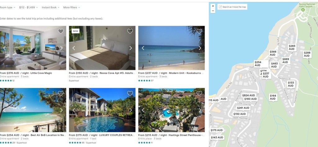
Airbnb has turned sharing our homes and living spaces with strangers from a fringe idea into an income. Much has been written in the media about this disruptive land use change, with most knowing somebody who is making a bit on the side by renting their house out during holiday time to fund their own holiday.

Over the last 5 years Council’s have taken a hands off approach to this disruptive land use change, however is this all about to change?

airbnb

The Noosa Plan currently requires an impact assessable planning application for a bed and breakfast use, while the Sunshine Coast Council Planning Schemes is more self-regulating allowing for up to 6 people stay for no more than 14 days, so long as the resident owner manages the stay and is reserved a room. However, with more than 1,000 listings on the Coast for short stay accommodation, there have been only 6 applications approved for a ‘bed and breakfast’ use in the last 5 years by both Councils.

Rather, Council has taken a ‘hands off’ approach only responding to complaints from neighbours when the temporary AirBnB residents get out of hand (i.e. party houses). In which case, the owner stops advertising, or buys a house nearby with more understanding neighbours.

Local Councils are having to respond to the other neighbours having to put up with the amenity impacts (noise, car parking, rubbish etc.). Academics and strategic planners have been complaining about the societal concerns associated with the impacts on the local rental market and social cohesion in these transient tourist areas. And now the tourism lobby are now complaining AirBnB is impacting on hotel chains bottom lines. Concern is raised about the lack of regulation of people running hotels out of residential buildings, and highlighting how Airbnb hosts do not collect hotel taxes, tourism levies and are not subject to the same health and fire safety regulations that hotel operators must follow.

In response, Noosa Council recently announced they are looking at ways to formalise AirBnB’s by creating a management policy (and a way of taxing) for the use within the new planning scheme. They have also asked LGAQ to lobby the State government to develop a policy response.

Considering other State Laws recently brought in to control ‘disruptive’ changes such as Uber (as a result of the Taxi Industry lobbying), which include the requirement for licences and annual fees – could this be the start of regulation for this disruptive land use change?

 A new plan for South East QLD – ‘From Cootharaba to Cambooyah to Coolangatta and everywhere in between’

SEQ plan and statistics

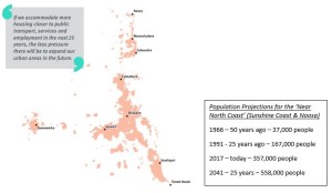
SEQ Plan and Population Statistics
Click on image to view larger size

Shaping SEQs is the third ‘big’ regional plan for South East Queensland and sets the parameters for land use planning to grow from 3.5 million to 5.3 million people in the next 25 years.he plan uses all the modern planning terms including responding to ‘global megatrends’, ‘missing middle housing’, ‘sweating our assets’, ‘inter urban breaks’, ‘place making’,  ‘disruptive technology’. However, what is much different from the previous plans to this version is the more collaborative approach the State are proposing to ‘work with’ the 12 local governments, which make up the region. 

What does it mean for the Sunshine Coast?

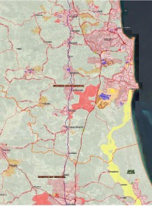
  • More development towards Brisbane with the expansion of ‘Beerwah East’ as a Ministerial Designated Area. Giving it special status as a large growth area requiring significant state infrastructure investment for its urban development.
  • Halls Creek (south of Stockland’s Aura development) is identified as a potential ‘Future Growth Area’. This means the land has at least been shown on a map for expansion in time the next update of the plan in 5 years.
  • The Sunshine Coast is required to accommodate 53,700 new ‘infill’ unit developments, and 33,300 new ‘greenfield’ developments over the next 25 years. Equivalent to 2,148 new units & 1,332 new detached house lots per year.

Opinion – A lot of the new detached house growth and development will be focussed on the southern end of the coast. Although ambitiously targeting more unit developments, the plan is for more quarter acre block on the outskirts of greater Brisbane.

What does it mean for Noosa?

  • No expansion of the urban footprint for the next five years.
  • The State want to see more consolidated development with 4,800 new ‘infill’ units, and 1,600 new ‘greenfield’ houses over the next 25 years. Equivalent to 192 new units & 64 new detached houses per year.

Opinion – These are fairly low and unambitious targets for growth in Noosa. Even with many sites being zoned for higher densities it is the individual landowner who is deciding whether it is worth building another 10 bedroom house on their unit zoned land near the river/beach.

What does it mean for Gympie?

  • Despite having a new 4 lane highway connecting Gympie to Brisbane making travel times less than 2 hours, there are no State urban footprint restrictions.
  • Gympie Council is planning for the overflow of South East Queensland and recently endorsed the Southside Local Development Area Structure Plan to accommodate a further 1,200 dwellings in an emerging uan area.

Opinion – Considering the greater connection with Brisbane and the Sunshine Coast, as well as the cheap cost of land in the area it will be interesting to watch Gympie’s growth over the coming years.

Regional plans are reviewed generally every five to seven years. Feel free to come in and speak to our qualified and experienced planners, who can provide greater insights into the opportunities and constraints for appropriate land development within the region.

 seq plan southseq plan north

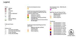
legend seq

All Aboard the Cross River Rail Project! What about the North Coast Rail Line?

By Jack Lewis

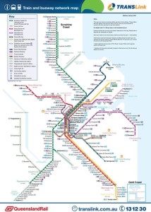
The South East QLD transport network connects the region from Gympie to the Gold Coast. As a sometimes user of the network, I can attest to the fact that the network is pretty efficient, air conditioned and modern compared with other regions and countries.

transport

However in South East Queensland the car is still the dominant form of travel, and while I can get a train from Gympie to Varsity Lakes that takes just under 5 hours, I predominantly choose to drive the 3½ hours, endure the tolls, roadworks and the overcrowded Nudgee service centre toilets.

Brian Feeney from the University of Queensland recently commented that the push by the QLD State government for the Cross River Project (reinforced by the Shaping SEQ plan) provides for a second railway connection through the Brisbane CBD, but at the expense of decentralisation. He argues this large infrastructure spending will serve areas that already have comparatively good public transport services, whereas the suburban and coastal areas where most people live would continue to have limited transport options.

Give most people a proper rational choice between driving and catching good public transport, and the decision will be between what is cheaper, more efficient and more environmentally sensible. If driving to Brisbane from the coast for and having to be somewhere by a certain time, most still choose driving.

The big growth for the coast in the Shaping SEQ plan document is to open up the southern end of the coast with new Stockland houses. Isn’t it time the State also pushed for a large infrastructure announcement for the North Coast Rail Line?

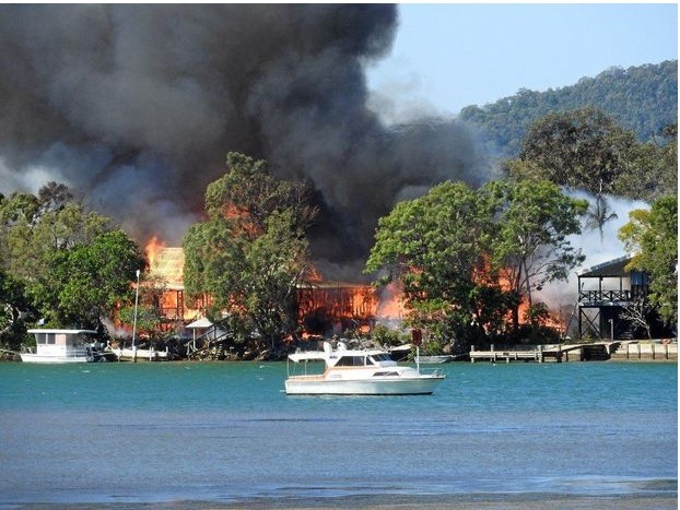
Fire Noosa North Shore

Fire Noosa North Shore – August 2017

Summer Bushfire Hazard

Spring is bushfire season in our region. We have already had some intense bushfire’s early in the season with houses being lost on the Noosa North Shore and evacuations at the southern end of the coast. Bushfire hazard planning is of critical importance to any new development.

Noosa Council recently refused an aged care facility on part of the Noosa Civic site, with the bushfire hazard risk likely to unduly burden disaster management response and recovery capacity and capabilities. New developments on the south end of the coast also forced residents to flee from their new estate houses.

Come and speak to our experienced and qualified planners who can assist in providing you the upfront information to avoid a costly Council refusal, or appropriate design responses to help manage bushfire risk.

Be Warned! Check how Existing Planning Schemes Have Been Amended To Align with New Planning Act

The new Planning Act commenced in July and introduces new terminology, processes and procedures.  Most local governments have also amended their plans to align with the new Planning Act.  However, there is no need for local governments to advertise or identify the amendments made to the plan.

Certain local governments have taken this opportunity to improve and clarify their previous local planning instrument/scheme without the need to undergo public consultation.  It has been discovered that one such Council has amended the following requirements:

  • Reducing the number of lots that can be developed for dual occupancy by over 50% (not allowing them to be located next to one another);
  • Introduced a maximum height in metres across all zones, rather than the previous and admittedly vague reference to height in storeys; and
  • Further restrictions on the subdivision of rural land for primary production (which is undefined).

Anyone who was considering to proceed with a development application under the previous Sustainable Planning Act is advised to check with a consulting planner to clarify the changes which may have resulted with the introduction of the new Planning Act.

Other News

The Sunshine Coast Council just can’t catch a ‘break’. With the Halls Creek expansion included within the Shaping SEQ Plan, despite Mayor Jamieson being vehemently opposed to Halls Creek being a potential Growth Area. Considering the break is currently approximately 20km wide, at least it’s not as narrow as the 2km between Ormeau and North Coomera on the Gold Coast.

Gympie is still on track to utilise more ‘Sun’ than the ‘Sunshine’ Coast, as a massive $2 Billion dollar solar farm on the outskirts of Gympie is in the approval process. If completed, the solar farm will power over 315,000 homes.

All the good weather has resulted in Section C of the Bruce Highway upgrade nearing completion, with the real possibility of the highway being opened before Christmas.

Note: If you’re having trouble downloading the links – Right Click the link and ‘Open in Incognito Button’ (Google Chrome) or Right Click the link and ‘Open in New Window” (Internet Explorer).

Contributors:
Jack Lewis B.Sc Hons UNSW, M.Plan OTAGO
Greg Martoo, B App Sc (Surv), Dip URP, M App SC (Urban Design), MPIA, MSIA
Certified Practising Planner, Registered Cadastral Surveyor
Nadine Gorton  BRTP, Grad Cert. Mgmt
Sarah Cole  BA (Pol Sci), LLB, L5B (Grad Cert Legal Prac)


Feedback requested by Gympie Regional Council on Final draft of Structure Plan for Southside LDA

Feedback requested by Gympie Regional Council on Final Draft of Structure Plan for Southside Local Development Area

160923_Draft Local Development Area Structure Plan 160923_draft-southside-lda


When the current planning Scheme over the Gympie Regional Council area first came into force in July, 2013, it limited future subdivision and land use development in three precincts around the city of Gympie until structure plans were adopted for each respective area by the Gympie Regional Council.  These three precincts are defined as local development areas in the planning scheme and within the localities of Southside, East Deep Creek and Victory Heights https://www.gympie.qld.gov.au/planning-scheme

Martoo Consulting has a long history and extensive experience in dealing with development proposals in and around each of these precincts.  Because of this Martoo Consulting has been liaising with Gympie Regional Council on Council’s proposal to adopt structure plans over these local development areas since before the current Gympie Regional Council planning scheme (2013) was introduced.  More recently Martoo Consulting has made submissions to Gympie Regional Council on behalf of several landowners on the preliminary Draft Structure Plan for the Southside Local Development Area.  Gympie Regional Council has recently released the final draft Structure Plan and has invited feedback from landowners and the broader community until 5pm on 23 December 2016.  Again Martoo Consulting is working with certain landowners and the general community to help ensure that their interests are better represent in the adopted Structure Plan for the Southside Local Development Area.    Martoo Consulting can be contacted if any assistance is required in providing feedback to Gympie Regional Council.


A NEW PLANNING SCHEME FOR NOOSA

Noosa Council is currently in its first stages of preparing and delivering a new local planning scheme. It is expected that these changes will roughly coincide with Queensland’s new planning reforms which will commence mid-2017.

The new scheme will replace the current Noosa Plan 2006 and is expected to have a planning horizon to 2036. The new Noosa Plan will serve as the region’s primary policy and directional document to help in managing change and development. Ultimately, the plan presents an opportunity to better dictate the future direction of the area by providing sustainable development that effectively serves the needs and core values of the local community.

Over the next 3 years, council will be actively preparing the new Noosa Plan, which is expected to be launched mid-2019. Council and its town planners will ensure a rigorous process of community consolation is undertaken to allow residents the opportunity to share their concerns and opinions and shape the direction of the new scheme.

A discussion paper will shortly be released in late October and we encourage any interested developers, investors, property owners and residents to provide feedback to Council to ensure all community and individual interests are best represented. This first stage of consultation will take place for 6 weeks until mid-December and provide the basis of information to influence and form the new planning scheme draft. It is our way of letting Council know what we cherish and value about our beautiful area and have a say in future development over the next decade and beyond.

Council will consider the communities feedback prior to commencing a draft of the new Noosa Plan in 2017. It is anticipated that a final draft of the new scheme will be made available to the public in 2018 prior to another round of community consultation.

With its home base in the heart of Noosa, Martoo Consulting understands the need for the new Noosa Plan to successfully dictate a sustainable future for the region. Our planners, who are also local residents, can appreciate your question and concerns. With many years of professional service, our staff can interpret your specific circumstances to the upcoming Noosa Plan changes and professionally compile this feedback to Council on your behalf.

Please contact us at our Noosa Heads office if you would like to discuss how we can help you. Also keep an eye out on our Facebook page for important reminders regarding public submission deadlines and progress updates for the new Noosa Plan.

3hastings 1sunshine-beach 2noosa-river


Changing land development scheme in the Gympie Region

3-02

Superseded Planning Scheme can no longer be requested after 1 July 2014

The Gympie Regional Council adopted the current 2013 Gympie Regional Planning Scheme on 1 July 2013, and as such, the one year anniversary for the take effect date is fast approaching – in less than a month from now.  Developments lodged to the Gympie Regional Council after 1 July 2014 will no longer be able to request assessment under the superseded 2005 Cooloola Scheme.

In some instances, this can significant affect the viability, profitability and design outcomes for the development of land.  It is suggested that even if you are considering developing land in the next 5-10 years time, that you urgently contact Martoo Consulting to conduct a due diligence exercise.

Our planners have the requisite experience to promptly provide advice on whether your approvals for possible future development should be started today – to avoid missing out.

Existing landholders, potential purchasers, and developers take note – this is an exercise which simply must be undertaken for anyone considering developing land in Gympie.

Regional and Rural Development focus of The Queensland Plan: a draft vision for the next 30 years

Shaping fundamental aspects of how our cities and regions might operate for the next few decades

The Queensland Plan

The Queensland Government has been busily and publicly active in the past twelve months, showcasing and shaping its new vision and strategy document;The Queensland Plan.  The widely-consulted strategy has just completed its community review stage.  The document largely centres on the State’s normative interests and portfolios, such as the economy, infrastructure, health and education.  This update focuses upon targets within The Queensland Plan relating to planning and development, giving an insight into how the Queensland Government is planning to shape our State’s built environment over the next few decades:

  • Regions – half of Queensland’s population lives outside South East Queensland.
  • Environment – Queensland has the best balance of environmental protection and economic development in Australia.
  • Infrastructure – the right infrastructure is delivered at the right place at the right time.

The balance of environmental protection and economic development is covered in greater detail in a previous post, and will not be discussed in any depth with this update.  The discussion of infrastructure delivery is indirectly given within this article’s focus upon the “Regions” element of the strategy directive.

Regions – half of Queensland’s population lives outside South East Queensland (by 2044).

At first glance, it may seem that this statement is easily achievable without much direct policy intervention.   However, for a population estimated at 4.66 million at the June Quarter of 2013, South East Queensland makes up approximately 70% of Queensland’s entire residential population.   Further, an assessment of Queensland’s broad hectare land supply, which is greenfield and brownfield land suitable for residential development greater than 2,500m2 in size, provides that South East Queensland holds an expected future dwelling yield of 450,000; accounting for 75% of dwelling yield across the entire State.

So, with a large population base, strong recent population growth, and the potential for a significant amount of future dwellings to be sited within the region, it stands to reason that it may be difficult redirect the inertia behind the steady trend of population growth within South East Queensland.  Once the logistics and cost that would underpin the sufficient and timely construction of public and community infrastructure is taken into account, which would be provided against the current trend of population growth, the scale of the commitment behind this strategy statement becomes more fully realized.

This strategy direction, if carried to fruition, would likely stimulate a large number of infrastructure upgrade projects across the State to support this growth.  Without already large rate bases, these infrastructure investments are not likely to be able to come from smaller Councils outside South East Queensland; limiting significant growth to areas within the larger regional areas of Mackay, Rockhampton, Cairns and Townsville, and undoubtedly with the added help of significant State or Federal regional infrastructure funding.

The far more difficult query relates is how the Government plans to stem the tide of greenfield, and indeed brownfield or infill development, in the burgeoning South East Queensland region, against the apparent momentum of this popular region?

Or is the plan to outstrip the long-standing growth trend in SEQ, with astronomical injections of funds to stimulate growth and infrastructure development in regional and rural areas of Queensland?  Will this come at the cost of those in the State who choose to settle in well-serviced and affordable areas of SEQ?  The finer points of this rural and regional revitalization are not known, and it is impossible to say how exactly such a plan would be delivered at this point in time.

The move by the Queensland Government to focus population growth, and hence economic growth, outside SEQ is a significant undertaking.  To limit impacts upon fringe agricultural lands in SEQ from our ever-expanding city centres, it could be a welcome development.  And so too for towns across Queensland which have been struggling in recent times with the pressures of metropolitan-focused population and societal growth, the “two-state” economy problem introduced by regional mining and gas projects, and fluctuating weather and commodities prices.  The growth would not come without the announcement of many and varied infrastructure projects across the State, which could be a welcome move for the construction and manufacturing sectors.

And it certainly would mean that developers looking to capitulate on this focus should start looking far and wide for opportunities to develop land across Queensland; as the growth in population in these areas will not occur entirely off the State’s back; and not without a concerted push from the urban development industry.

The Mary Valley – Growth and Strategy for revitalisation

Mary Valley

The Department of State Development, Infrastructure and Planning (DSDIP) have been focusing their efforts on growing the economy of the MaryValley, linked with the State’s sale of property in the region, centred around the potential for;

  • Growing agribusiness;
  • Growing small business; and
  • Growing tourism.

The economic development strategy for the MaryValley region, as developed by DSDIP, can be viewed here.  Further, properties for sale through the State are available for viewing here.  It is also possible to submit proposals or register interest in developing land to the Mary Valley Economic Development Office at 46 Main Street, Kandanga.

As specialists in land development for particularly the Gympie and SunshineCoast regions, contact us to find out if your designs on a MaryValley life or business are compatible with the planning schemes and other development constraints regulating land development in Queensland.

Our services may include assisting with site due diligence, co-ordinating the preparation of economic development proposals, and regular town planning, environmental approvals, or surveying work for inclusion in development applications for Council and the State Government.  For a full list of our services, please see our website or contact us.


Planning reform in Queensland

Updates on the Newman Government’s State planning reforms

If you’ve been active in the development space over the last few years, you may have noticed the incremental roll-out of the Newman Government’s policy and planning legislation reform, significantly changing the game for developers in Queensland.

This newsletter will chronicle the release of reforms as they are announced and as they come into force, helping distil what the changes mean for those in the industry, and what could arise out of the various shifts in focus which have been set in motion by the Newman Government.

So far we’ve seen significant changes from 2013, including the following:

  • Installment of the State Assessment and Referral Agency (SARA) and online myDAS portal;
  • State Development Assessment Provisions (SDAPs)
  • Single State Planning Policy;
  • Queensland Planning Provisions;
  • Sustainable Planning Act and Other Legislation Ammendments (SPOLA) Act 2012;
  • Environmental Protection (Greentape Reduction) and Other Legislation Amendments Act 2012; and
  • Vegetation Management Amendment Act 2013 (and self-assessable codes)

With the following milestones yet to come in 2014 and 2015:

  • Changes to infrastructure charges framework – mid 2014
  • Planning for Queensland’s Development Act (to replace the Sustainable Planning Act) – late 2014-mid 2015
  • Updating regional plans – to the end of 2014
  • Updating of local planning schemes – ongoing

All of these changes have a significant impact upon the development application process involving almost every type of conceivable type of urban land development in Queensland.

Accordingly, certain types of development activity regulated under planning or environmental legislation, which was previously unviable, may now be achievable with the effects of the reform.  Conversely, these changes may impose different or further challenges or restrictions upon land use matters in Queensland.

Time is the critical element here, and finding out where your development stands sooner rather than later could add significant advantages and save you time and money through the concept design and assessment stages.

If you would like to discuss a particular development with us, and how it’s status may change with the roll out of State legislation or policy, get in contact with our Gympie or SunshineCoast office and one of our staff will assist with your enquiry.


Noosa Council and Sunshine Coast Regional Council– what it means for the Sunshine Coast

Two new local governments, two distinct and fresh approaches –

Noosa

On January 1, 2014, the local government conglomerate of Maroochy Shire Council, Caloundra City Council, and Noosa Council, known since 2008 as the Sunshine Coast Regional Council, ceased to exist.  In its place rose two new Council configurations; a reinstatement of the Noosa Council, and the Sunshine Coast Regional Council comprised of the former Maroochy Shire Council and Caloundra City Council areas.  This change was one fought for a long time by residents of Noosa, seeking de-amalgamation from the broader local government of the SunshineCoast.  While the reformation will ultimately allow Noosa Shire residents to solely direct their Council’s future, both Councils have exciting new paths and challenges ahead of them, in order to select and set the scene for living and working on the SunshineCoast over the next decade and beyond.

The draft Sunshine Coast Regional Council planning scheme has gone through public consultation and review, with the scheme currently with the State government awaiting Ministerial sign-off for implementation.  The new scheme is expected to be endorsed around March 2014, according to the Sunshine Coast Regional Council’s (SCRC) website.  The new SCRC planning scheme has been drafted utilizing the Queensland Planning Provisions; the State’s template for local governments preparing planning schemes in order to encourage a consistent approach to scheme layouts, wording, and particularly land use definitions.

The new SCRC planning scheme, as a QPP plan, will look and feel like other new planning schemes in Queensland.  This means that zone types and land use definitions will be the same state-wide.  A number of facets of the new SCRC planning scheme are specific to the Sunshine Coast region, including a declared activity centre in Maroochydore (the Principal Regional Activity Centre – PRAC), a lenient change in residential dwelling density tests (“equivalent dwellings per hectare” as opposed to “dwelling unity factors”), and significant changes both encouraging and prohibiting duplex development in low density areas.  The introduction of the new scheme will inevitably change the direction of development in the SunshineCoast, regardless of what form it ultimately takes.

Noosa Council currently regulates development under the 2006 Noosa Planning Scheme (‘The Noosa Plan’), which was also the relevant document for the area while Noosa Shire was part of the Sunshine Coast Regional Council.  This 2006 scheme will remain in force until such a time that a new scheme takes effect.  Our planning team has been working with The Noosa Plan since its inception in 2006, and can accordingly provide an experienced service to those seeking advice on matters within the Shire of Noosa.  We look forward to helping our clients both presently with the current scheme, and also into the next phase of Noosa’s planning and development progression.