Archive for Gympie Region – Page 2

The Mary Valley – Growth and Strategy for revitalisation

Mary Valley

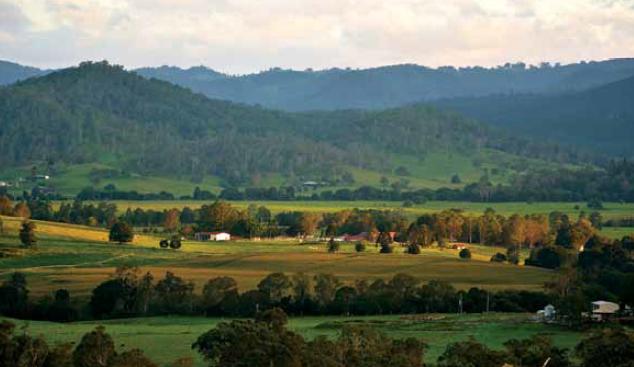
The Department of State Development, Infrastructure and Planning (DSDIP) have been focusing their efforts on growing the economy of the MaryValley, linked with the State’s sale of property in the region, centred around the potential for;

  • Growing agribusiness;
  • Growing small business; and
  • Growing tourism.

The economic development strategy for the MaryValley region, as developed by DSDIP, can be viewed here.  Further, properties for sale through the State are available for viewing here.  It is also possible to submit proposals or register interest in developing land to the Mary Valley Economic Development Office at 46 Main Street, Kandanga.

As specialists in land development for particularly the Gympie and SunshineCoast regions, contact us to find out if your designs on a MaryValley life or business are compatible with the planning schemes and other development constraints regulating land development in Queensland.

Our services may include assisting with site due diligence, co-ordinating the preparation of economic development proposals, and regular town planning, environmental approvals, or surveying work for inclusion in development applications for Council and the State Government.  For a full list of our services, please see our website or contact us.


Planning reform in Queensland

Updates on the Newman Government’s State planning reforms

If you’ve been active in the development space over the last few years, you may have noticed the incremental roll-out of the Newman Government’s policy and planning legislation reform, significantly changing the game for developers in Queensland.

This newsletter will chronicle the release of reforms as they are announced and as they come into force, helping distil what the changes mean for those in the industry, and what could arise out of the various shifts in focus which have been set in motion by the Newman Government.

So far we’ve seen significant changes from 2013, including the following:

  • Installment of the State Assessment and Referral Agency (SARA) and online myDAS portal;
  • State Development Assessment Provisions (SDAPs)
  • Single State Planning Policy;
  • Queensland Planning Provisions;
  • Sustainable Planning Act and Other Legislation Ammendments (SPOLA) Act 2012;
  • Environmental Protection (Greentape Reduction) and Other Legislation Amendments Act 2012; and
  • Vegetation Management Amendment Act 2013 (and self-assessable codes)

With the following milestones yet to come in 2014 and 2015:

  • Changes to infrastructure charges framework – mid 2014
  • Planning for Queensland’s Development Act (to replace the Sustainable Planning Act) – late 2014-mid 2015
  • Updating regional plans – to the end of 2014
  • Updating of local planning schemes – ongoing

All of these changes have a significant impact upon the development application process involving almost every type of conceivable type of urban land development in Queensland.

Accordingly, certain types of development activity regulated under planning or environmental legislation, which was previously unviable, may now be achievable with the effects of the reform.  Conversely, these changes may impose different or further challenges or restrictions upon land use matters in Queensland.

Time is the critical element here, and finding out where your development stands sooner rather than later could add significant advantages and save you time and money through the concept design and assessment stages.

If you would like to discuss a particular development with us, and how it’s status may change with the roll out of State legislation or policy, get in contact with our Gympie or SunshineCoast office and one of our staff will assist with your enquiry.


Lord of the Regions: Queensland’s Single State Planning Policy


The Newman Queensland Government’s approach to the State’s planning policy has been revealed as one of consolidation; introducing a single state planning policy (SPP) to replace the multiple policies previously in existence.  The SPP has two important roles; in guiding local governments to identify and implement state interests, and also for applicants in formulating their development proposals.

Lord of the rings

Aside from governmental functions including making or amending planning schemes or regional plans, the SPP has two important applications being for:

  • the designation of land for community infrastructure (CID) for things such as:
    • hospitals;
    • educational facilities;
    • railway facilities;
    • parks and recreational facilities; and
    • government administrative offices and works depots.
  • Assessment of a development application according to the interim development assessment requirements until the SPP is integrated into planning schemes (any scheme made after the SPP came into effect on 2 December 2013)

Some state interests have supporting mapping to assist in spatially representing policies or requirements outlined in the SPP. There is mapping for both local government plan making and development assessment purposes. This mapping is contained in the SPP Interactive Mapping System.

The SPP is set out according to five core themes, under which sixteen (16) interests are grouped.  The themes and their respective interests are the following:

1.    Liveable communities and housing

1.1. Liveable communities

1.2. Housing supply and diversity

2.    Economic Growth

2.1. Agriculture

2.2. Development and Construction

2.3. Mining and Extractive Resources

2.4. Tourism

3.    Environment and Heritage

3.1. Biodiversity

3.2. Coastal environment

3.3. Cultural Heritage

3.4. Water Quality

4.    Hazards and safety

4.1. Emissions and hazardous activities

4.2. Natural hazards

5.    Infrastructure

5.1. Energy and water supply

5.2. State transport infrastructure

5.3. Strategic airports and aviation facilities

5.4. Strategic ports

Not all of the interests listed above are relevant to development assessment, even in the interim until the SPP can be integrated into planning schemes and the interim development assessment provisions apply.  Only the following interests apply, according to how they are set out in the new interim development assessment requirements in the SPP:

  • extractive resources;
  • biodiversity in relation to a matter of state environmental significance;
  • coastal environment where on land in a coastal management district;
  • water quality;
  • natural hazards;
  • emissions and hazardous activities;
  • state transport infrastructure; and
  • strategic airports and aviation facilities.

With a number of planning schemes under review, or scheduled for review in the near future, the Single SPP along with the ever-updating Queensland Planning Provisions, and other relevant planning instruments, are sure to be cornerstones of the Newman Government’s planning legacy, as it is constructed and unfolded before our very eyes.

It remains to be seen whether the level of change from a planning framework perspective is having an effect upon the simplicity and warranted success of development applications; it should be said though that the distinctive move from ad hoc and numerous, toward consistent, consolidated and duly iterative, is a welcome directive in spite of the short term complexity it presents.

New Gympie Regional Council Planning Scheme: six months on

Time running out for assessment under the old Cooloola Shire Planning Scheme

Gympie Town

The Gympie Regional Council adopted its new planning scheme a little over six months ago, on 1st July 2013.  The new planning scheme applies over areas under the old Cooloola Shire, Tiaro Shire, and Kilkivan Shire planning schemes, taking into account the Gympie Regional Council’s plan for development and the new requirements from the State with regards to land use planning.  Accordingly, the zones, levels of assessment, use definitions, infrastructure plans, and other key aspects of any planning scheme have been updated in the new scheme, meaning that a development can be considered differently between the old schemes and the new Gympie Regional Council planning scheme.

An application can be made under the old planning scheme for a period up until twelve months after the new scheme came into effect.  This means until the 1st July 2014, an applicant considering developing their land can still apply to have the application assessed under the old scheme.  This provision exists State-wide, and is intended to allow flexibility for landowners who may have their plans for development seriously affected or altered due to the effect of a new planning scheme.

It is essential to contact one of our experienced planners in order to determine whether there is any benefit in lodging your application for development under an old scheme.  The difference between schemes can be quite substantial, with changes to land zonings, minimum lot sizes for subdivision, levels of assessment for land use changes and other development, and use definitions being typically the key applicable changes.  This can have bearing upon any application, including primarily;

  • Subdividing small blocks or subdivision for an estate, or other reconfigurations of a lot; and
  • Changing the use for commercial, industrial or residential purposes (eg. Shop to factory, house to workshop, café or restaurant to tourist accommodation, etc.).

The new Gympie Regional Council Planning Scheme has also been extensively utilized in applications prepared by Martoo Consulting in the latter half of 2013, and in to 2014 as well.

For more information on our experience and capabilities in our Gympie region, please get in contact.  Our Gympie office is located in the centre of town, and we’d be only too happy to discuss your development opportunities.

The changing face of development in Queensland: Vegetation Management

New regulations govern the use of vegetated land balancing economic and environmental outcomes

Vegetation Management

The legislative and policy framework governing vegetation clearing in Queensland for a range of land uses and development scenarios has changed, with aims to balance good environmental outcomes with correspondingly appropriate development proposals.  Accordingly, development that was previously prohibited or difficult to carry out due to the structure of the previous framework may now be possible, providing that a good case be made for the development against the criteria of the new framework.

The assessment of clearing generally still depends on the following considerations:

  • the type of vegetation (as indicated on the new regulated vegetation management map and supporting maps);
  • the tenure of the land (e.g. freehold or Indigenous land);
  • the location, extent and purpose of the proposed clearing; and
  • who is proposing to do the clearing (e.g. state government body, landholder).

The recent shift provides a raft of significant changes, including different exemptions for clearing purposes, new self-assessable codes, and a new simplified mapping of regulated vegetation over lots in Queensland.  The vegetation categories on the new map are:

  • Category A (red): areas subject to compliance notices, offsets and voluntary declarations
  • Category B (dark blue): remnant vegetation
  • Category C (light blue): high-value regrowth vegetation
  • Category R (yellow): regrowth vegetation within 50m of watercourses in priority reef catchment areas
  • Category X (white): areas not regulated under the Vegetation Management Act 1999.

A significant change for most of the developments Martoo Consulting has experience in gaining approvals for – being small subdivisions to large estates, duplexes to multi-storey complexes and shopping centres, schools to marinas and community infrastructure, and even backpackers and bed and breakfasts – is the change in level of assessment from 2 hectares to 5 hectares.  This means that lots less than 5 hectares in area will not be assessed for clearing proposed as part of a development.

The new self-assessable codes and clearing exemption purposes will also likely provide for some significant changes in terms of level of assessment; however these purposes and exemptions tend to be more circumstantial and applicable on a case-by-case basis.

In terms of the outcomes required of developments assessed against the State’s development assessment for vegetation matters, a renewed focus has been cast upon “environmental offsetting” as an acceptable outcome for some clearing that cannot be avoided or minimised.  Offsets can be made either through direct offsets (suitable land with good quality vegetation under an on-title security such as a covenant) or indirect offsets (the payment of an appropriate sum to the government), means that the environmental impact may be considered economically quantifiable and financial penalties enforced accordingly,  instead of the environmental damage being unequivocally prohibited.  The process is somewhat complex, requiring typically an amount of field surveying to determine the ecological equivalence of both the land to be cleared, and in the case of direct offsets, the land provided as an offset.

Martoo Consulting has experience in managing offsets for properties in Queensland, though a significant change to the Queensland Biodiversity Offsets Policy (QBOP) has been earmarked by the Department of Environment and Heritage Protection for early 2014, which will also require consideration upon publication for any significant changes affecting industrial, residential, commercial and agricultural land uses in Queensland.

To find out more about your property or development, and how it fits in with the changes in the environmental planning space, get in contact with Martoo Consulting and one of our experienced planners can talk you through the options you have at your fingertips.

Gympie Regional Council has now adopted the New Planning Scheme

Gympie Regional Council has now adopted the new planning scheme for the whole of the Gympie Regional Council area.  This new Gympie planning scheme will have force and effect from 1 July, 2013 and supersedes the 2005 planning schemes for the former Cooloola Shire area, the former Kilkivan Shire Area as well as the southern part of the former Tiaro Shire area.

The new 2013 Gympie Planning Scheme does provide new and longer term opportunities for the development of certain land in the Gympie Regional Council area.  It is possible to request that Gympie Regional Council assesses development applications lodged between 1 July 2013 and 1 July 2014 under the then superseded planning schemes being for the former Cooloola, Kilkivan and Tiaro local government areas.  It is recommended that intending applicants obtain professional town planning advice from a town planning consultant before deciding to lodge a development application with Gympie Regional Council. 

Martoo Consulting is a local consultant with extensive local experience and knowledge and therefore in a great position to assist in providing such advice.

GYMPIE REGIONAL COUNCIL RELEASES ITS NEW DRAFT PLANNING SCHEME FOR PUBLIC REVIEW AND FEEDBACK

The Gympie Regional Council has released the Draft Gympie Whole Region Plan for review by the public and has invited community feedback to all aspects of this proposed planning scheme.

If you are a property owner, investor or resident in the Gympie Regional Council area or just an interested member of the public, you have an opportunity to fully appreciate what is being proposed in this whole of region  Planning Scheme and associated Planning Scheme Policy and how this may affect or influence your future investments, lifestyle and amenity as this Draft Gympie Region Plan will strongly direct the development of all government and privately owned properties throughout the whole of the Gympie Regional local government area for the next 7 or so years.

The Draft Gympie Region Plan presents preferences for future development of the Gympie Regional Council area documented as a result of lengthy liaison between the Gympie Regional Council and the Queensland State Government.

Therefore it is strongly recommended that property owners, investors, residents and any other interested members of the public provide Gympie Regional Council with feedback now in response to the Draft Gympie Region Plan so that the Council can ascertain that community or individual interests are best represented for future uses and priorities.

Your public feedback which identifies concerns with particular provisions of the Draft Gympie Region Plan is potentially more effective in influencing Gympie Regional Council when it is professionally prepared and therefore clearly and accurately identifies the grounds for such concern and provides detailed sensible and logical alternative approaches that could be included in the adopted version of new Gympie Region Plan to address such concerns.

The closing date for submissions is Wednesday 28 November 2012.  All submissions must be received by Council on or before this date. 

How can we help you?

We offer our clients an extensive experience in the documentation, consultation and feedback phases of planning schemes, particularly here in Gympie where our highly regarded staff has had many years of professional service to the residents of Gympie and surrounds in the areas of Town Planning, Surveying, Urban Design and Development Management. 

In this way we can fully appreciate your questions, concerns and potential implications. We then interpret your specific circumstance to the current and Draft Gympie Region Plan and professionally compile this feedback to Council on your behalf.

 Please contact us at either our Gympie or Noosa Heads office if you would like to discuss how we can help you. 

NEWS FLASH – Draft Gympie Region Plan Released for Public Feedback

 cooloola 

Martoo Consulting: We proudly plan places with development solutions people value.